Propeller Platform
Propeller simplifies daily oversight using a map-based command center with analytics tools and reporting capabilities. Connecting all your site docs in one hub, you’ll reduce operating costs, align your team, and keep proof of work on hand.
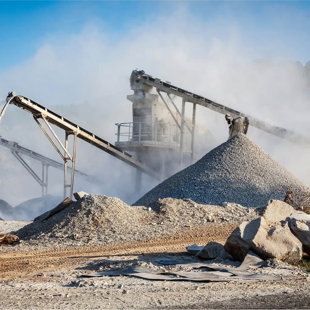
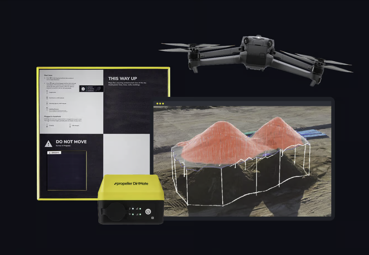
Upload surface data from the capture or survey tool that best matches your accuracy needs. This could be drone mapping, GNSS rover, total station, or other conventional methods. Propeller brings it all together into one unified map. Our high-precision processing ensures that every data point aligns reliably, no matter how it was captured. With everything in one place, your team can trust the map and make confident, accurate decisions across the site.
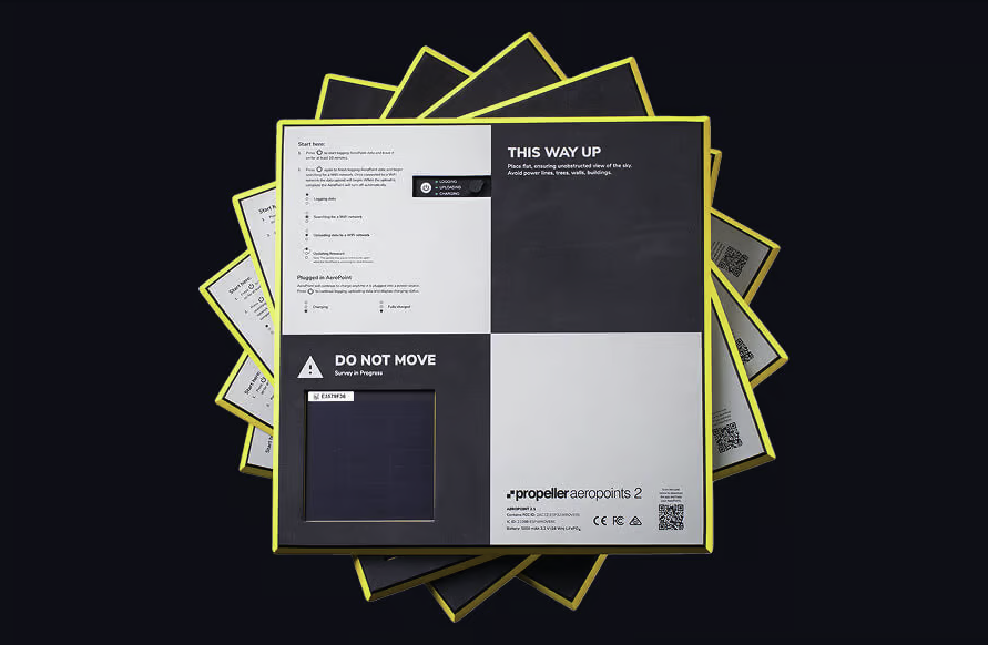
“We were within 2/100ths of a foot of our lidar scan—Propeller just works. The AeroPoints are like gold when you’re flying a drone.”
– John Triska, Owner at 3D Data Prep Inc
Keep your site in your pocket, on your desk, or even in the cab of your machines. With a simple, cloud-based map you easily keep tabs on what’s complete and what’s left to do from wherever you are – no matter your technical background.
“Now, we can see the sites we’re considering building and pull them up in Propeller, and look at them and analyze them all together. That’s been really exciting.”
– Lonny Reed, Owner at Legend Engineering
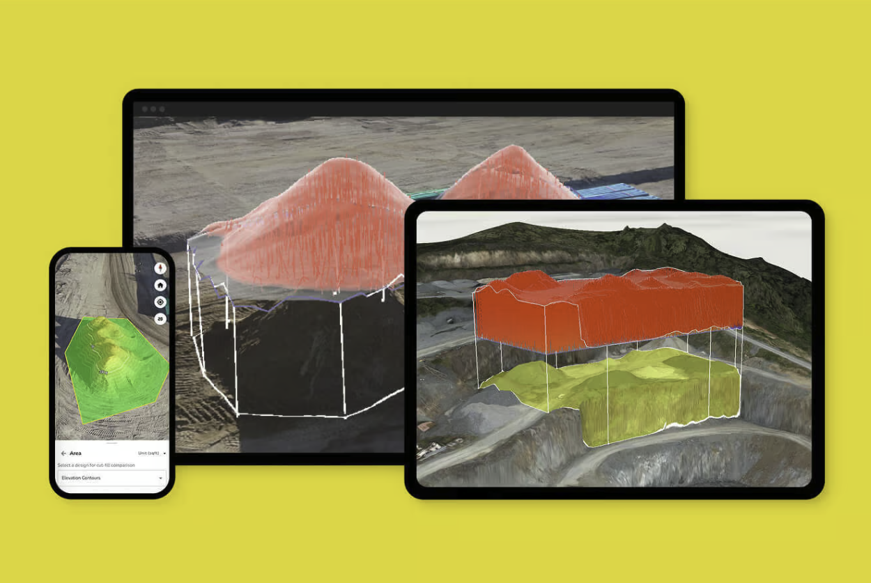
Bring your designs to life. Whether they come from CAD, drone surveys, or site layouts, you can overlay design files directly onto the map. Your team can annotate, mark up, and add context from the field so everyone in the office and on site can make confident decisions and collaborate seamlessly.
“Trimble Stratus powered by Propeller gives my clients who don’t speak CAD a far better understanding of the site. They can finally visualize what’s going on.”
– Bryce Morehart, Vice President and Chief Drone Pilot at Morehart Field Services

Rather than storing site docs across many systems, you’ll manage everything in Propeller. Bring all your geospatial data–from PDF design plans to TIN surfaces–together in a shared workspace. With one truth, the whole project team stays aligned and works smarter.
“We use Propeller as a communication platform. Sharing updates, raising issues, and walking projects like we’re right there on site together.”
– Hayden Taylor, Quarry Manager at Lehigh Hanson
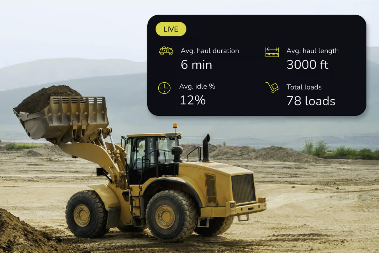
Take drone mapping to the next level by bringing live machine data right onto your site map. See where your machines are, track cycle times, and monitor utilization in real time. This seamless integration helps you cut downtime, boost operator efficiency, and keep every team member working from the same updated view.
“With the machine data from DirtMate and the accuracy Propeller provides through drone surveys, we’re very satisfied. These solutions help us quantify our earthmoving and conduct drone surveys monthly or bi-weekly based on our needs.”
– Thomas Loewen, Owner at Summit Excavation + Grading
Where we work


Connect surveys from different sources on one map. Upload raw inputs for processing or pre-processed surfaces to analyze immediately.
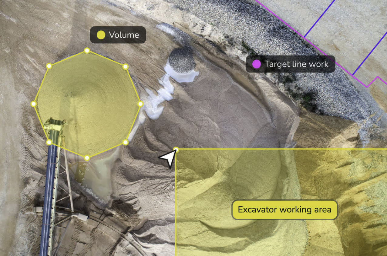
Get precise measurements across your site. From distances and volumes to heights and grades, measure exactly what matters.
Monitor your machines live from the map to reduce idle time, identify issues, and create accountability across your field team.


Keep projects tidy, permissions secure, and data easy to access when and where you need it. Access all of your documentation from one central hub.
Stay ahead of site challenges with predictive modeling and overlay designs on your reality to close the gap between current and future state.
Bring your teams together. Share data, reports, and visuals that connect the field to the office, keeping everyone aligned.
Our products
Core Product
A cloud-based hub to map, measure, and manage your projects with your team.

A drone photogrammetry and lidar processing pipeline for fast, hassle-free results.
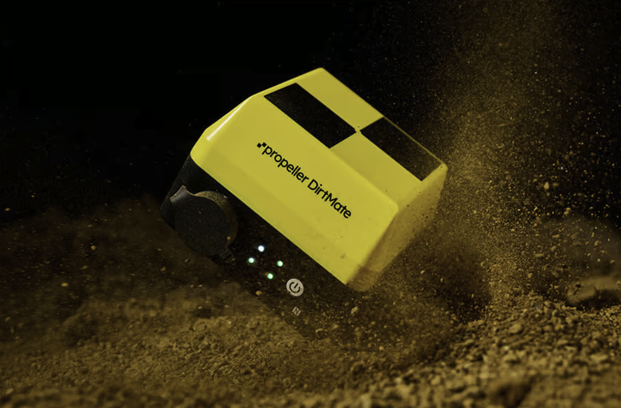
A GNSS receiver that unlocks real-time telematics in Propeller. See your machines on the map.
The only smart ground control points, making survey-grade data simple.
Where we work